 |
 |
 |
|
|
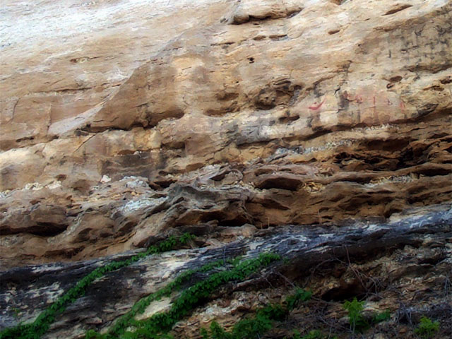
Photo 42 of 100 :: Day 2, Friday, 3 May 2002
There used to be a great set of petroglyphs on these bluffs. You can only make out one now (see the red semi-circle with the dot above it? This is what it used to look like.). Many others were blasted away when the railroads destroyed the stone overhangs in order to prevent train accidents.
The Lewis and Clark Expedition passed through this area and Clark noted the pictographs in his journal, dated 7 June, 1804. “...Set out early passed the head of the Island opposit which we Camped last night, and brackfast at the Mouth of a large Creek on the S.S. of 30 yds wide called big Monetou, from the pt. of the Isd. or Course of last night to the mouth of this Creek is N 61 degrees W, 4 1/2 ms. a Short distance above the mouth of this Creek, is Several Courious Paintings and Carveings in the projecting rock of Limestone inlade with white red and blue flint, of a verry good quality, the Indians have taken of this flint great quantities...” |
 |
 |
|
 |
 |
|
|